Set out for a great day of hiking Mount Moosilaukee (Sept 14th, 2014). 4,802 feet and you can see 34 of the other 4,000 footers in NH. Pretty cool! The hike was about medium difficulty. It was actually pretty easy hike but anytime you ascend to that height it usually requires some effort. Made pretty good time but didn't rush and stopped throughout to take in the views. The descent was quite easy comparatively. The day started cool but with the sun it was absolutely perfect hiking temperature. Very light breeze. Couldn't have asked for better! The summit is pretty unique with a spread out feel and lots of alpine grass.
Nice brisk start to the morning! (7:27am) After a 1 hour 45 minute drive to the parking area.

Started out trying to find the right trail. Eventually found this cutoff. (5min in)

First "real" trail sign - sign in station - ready to go! (11min in)

Bridge over the fresh water! (24min in)

Trail has been re-routed due to hurricane damage (31 min in)

Connection back to Gorge Brook called Wales Carter Connection (1 hour in)

Last sure water! (1hr 31min in)

First real glimpse of the views with a nice viewing area! (1hr 48min in)


Another nice viewing area further up the trail. Anxious for the summit views! (2 hours in)


Finally breaking out to the summit area. If you look REAL careful you can see the summit from here with a little orange sign. (2hrs 14min in)

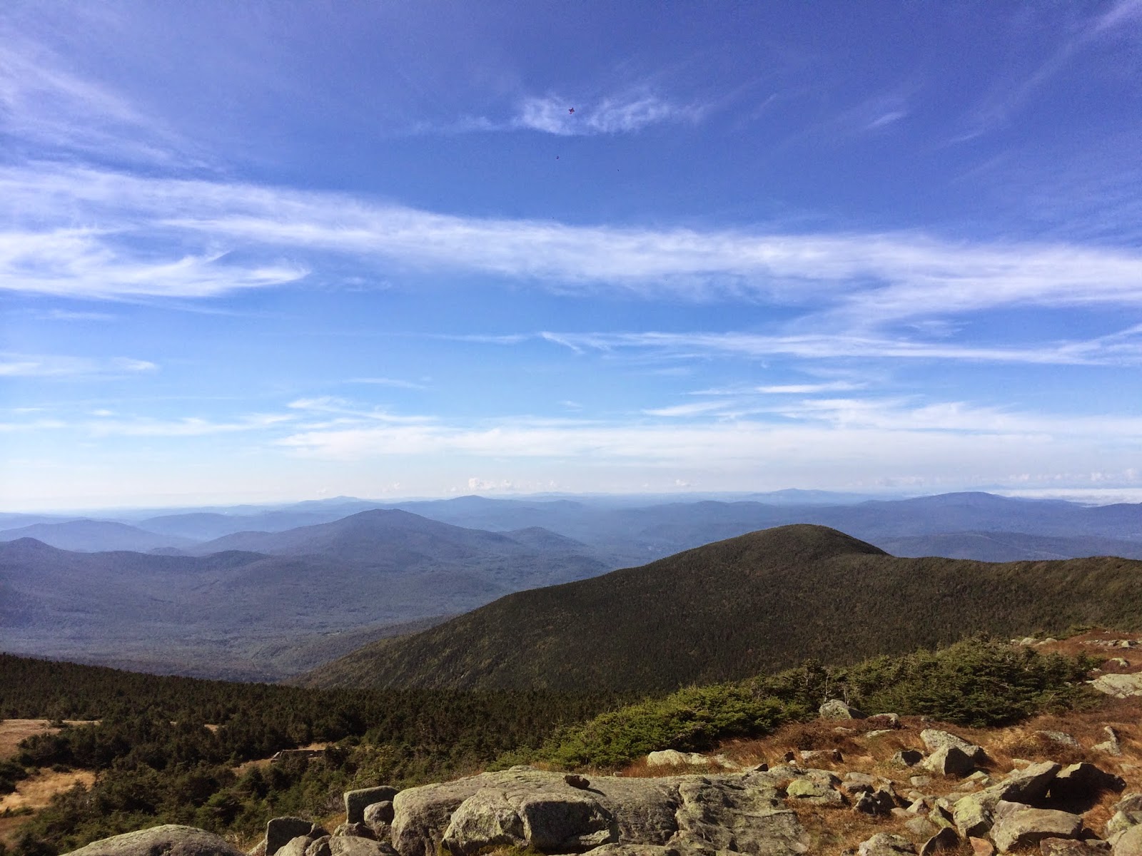
Arrived at the summit! - 9:50am -- first one there that morning and had the summit all to myself for awhile. (2hours 20 mins in)

Absolutely beautiful morning. Great views.

You can see the clouds settled into some of the valleys. Awesome to see.


Proof that I really did make it!


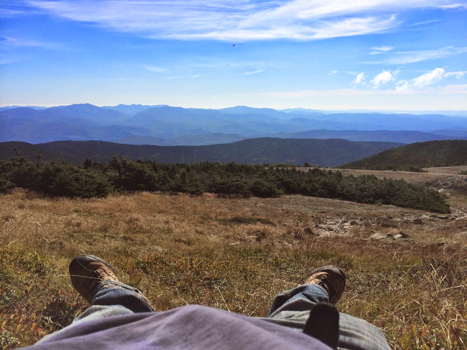
Found a nice plate to sit out of the wind in the sun.

Found an even better place in the grass. It was like God made a grass hammock for me! Out of the wind, in the sun. It was sooooo quiet. I actually napped for a bit. A few hikers went past as well.
You can see another hiker coming up Gorge trail in this picture.


Rested, relaxed, ate lunch for 1 hour and 35 minute. Time for the descent to begin (11:25am) Descended down Carriage Road trail to start with. Unique trail. (4min into the descent)

Just another picture of the unique trail (8min into the descent)

Amazing how these plants are so incredibly durable to stand the harsh alpine conditions but yet are so vulnerable to non-natural harm. (11min into the descent)

Took a little trail spur to check out South Peak (15min into the descent)

4 minutes later arrived at South Peak... more great views! (19 min into the descent)

Took a bunch of pictures trying to capture the view (but never quite doing it justice). Spent about 10 minutes at this summit.


I highly doubt you'll see it but if you look REAL close you'll see a red helicopter that was flying through the ravine. Pretty neat to see a helicopter flying below you like that.

Helicopter is in this picture also but even harder to see.

After South Peak connecting back to the Carriage Road trail (23 min into the descent)

Connecting to Snapper trail. Almost missed this sign! (50 min into the descent)

Random panoramic picture on the descent. Picture doesn't show just how beautiful it was (1 hour 3 min into the descent)

Back to the connection where I had split off on the ascent (1 hour 12 min into the descent)

Descent almost complete! Sign and bridge to the Lodge (1 hour 16 min into the descent)

Trail split towards the bottom - looking back up the trail (1 hour 24min into the descent)

Bridge (close to the lodge) - (1 hour 26 min into the descent)

Went down the side and relaxed at the side of the river for awhile. Great way to end a hike in the White Mountains!


Real cold but refreshing for my feet! Probably spent about 10-15 minutes here.

If you look real carefully down the river you'll see the bridge through the trees. Heading back there to get back to the lodge and officially end the hike.

Made it to the lodge! (1 hour 32 minute total descent excluding stops at South Peak and the river) - arrived 1:30pm

Looks like they're building some new lodges or bunkhouse. Mountains in the distance.


Made it back to the car. Total active hiking time. 4 hours 7 minutes. Total day trip time including stops was 6 hours and 3 minutes. Not to bad (now for the 1 hour 45 minute drive home)

Started at 31 degrees, finished at 52. Great day and great hike!
